Under the Intelligent Access Program (IAP) framework, certified service providers are responsible for monitoring heavy vehicles and mobile cranes against their condition of access to the road network in NSW. If a monitored vehicle breaches their condition of access, the certified service provider must generate what is known as an NCR (non-compliance report) and forward it to the RMS for assessment, investigation, and enforcement action. RMS required a data management system to manage this data flow.
The Solution
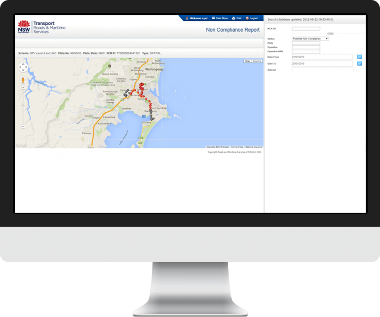
We built a web-based tool to analyse the non-compliance reports (NCRs) for heavy vehicles, with data coming from the Intelligent Access Compliance Database (IACD). A Google Maps API is used to highlight vehicle routes, approved routes, restricted bridges, and trend analysis, with appropriate colour coding for easy visual analysis of the data. The new system provides a significant increase in processing speeds, automated workflow, and trend analysis capabilities.
Benefits and features
Improving corporate compliance
The new system provided RMS with the ability to monitor and observe all heavy vehicle movements around NSW. RMS staff are now able to see the location and routes of all heavy vehicles, and can monitor and report on all movements to ensure that all routes are complaint. Non-compliance reports are also available to be provided as evidence.

Informed decision making
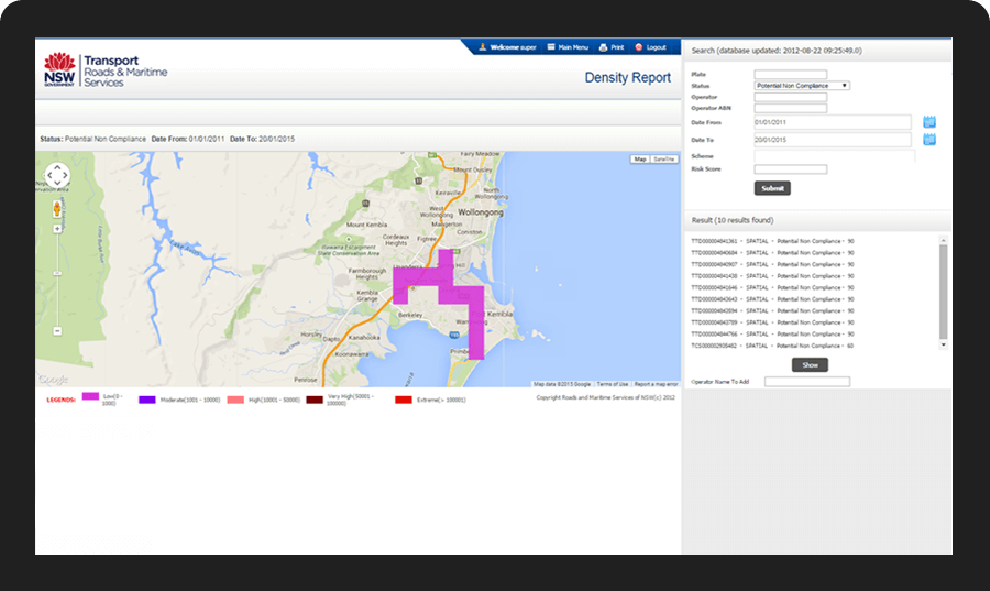
This data management software utilises trend analysis. The colour map shows routes with heavy traffic and uses this information to determine the optimal route. This ensures congestion or other local restrictions, such as residential areas, are avoided.
Increased business agility
RMS was limited with their technology systems. By creating a new satellite system, data is now easily accessible and transferable, resulting in more informed decision making, an increase in business performance and speed in addressing issues, and ultimately, business efficiency for RMS.


Increased productivity
By automating what was once a very manual process into a streamlined, accurate and real-time function, output is noticeably increased. This has resulted in the immediate identification and address of any compliance breaches, improving road safety.
Technology
The user interface and reporting was developed in Java J2EE with JSP, Javascript and JQuery. A MySQL database was used for data storage and retrieval with a batch module accessing an Oracle 10g database. The Google Maps API was used for NCR and Density Reporting.